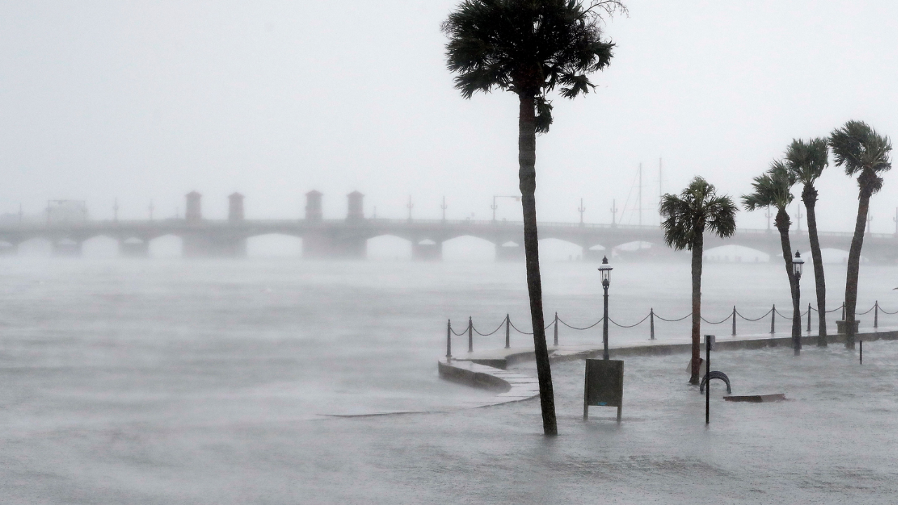
Hurricanes are a real factor in coastal Florida, and St. Augustine can experience flooding from storm surge, heavy rain, and even high-tide (“king tide”) events. The risk isn’t uniform—flooding varies dramatically by elevation, proximity to water, drainage, and flood zone, so you should evaluate it by exact address using official flood maps.
How big of a deal are hurricanes and flooding in St. Augustine specifically?
- Hurricanes: You’re managing wind + power outage risk, plus potential storm surge in certain coastal/low-lying zones.
- Flooding: Can come from surge, rainfall, and tidal “nuisance” flooding—especially in low elevations.
- “Worst vs best” areas: It’s less about neighborhood labels and more about address-level elevation, flood zone, and drainage pathways.
- Best approach: Use FEMA + county/city flood tools, then validate with practical, property-specific checks.
- Bottom line: Don’t decide based on headlines—decide based on the property’s measurable risk profile.
Why St. Augustine flooding can feel confusing (and why it’s not “all the same”)
If you’re relocating, it’s easy to look at one dramatic photo of a flooded street and assume, “So the whole city floods.” The reality is more nuanced. St. Augustine is a coastal, low-lying historic city with waterways and tidal influence, which means certain pockets can flood while other areas nearby stay relatively dry. There are also different flooding “types,” and they don’t behave the same way:- Storm surge flooding (hurricane-driven coastal water pushing inland)
- Rainfall flooding (intense rain overwhelming local drainage)
- Tidal / king tide flooding (high tides pushing water onto low streets)
"My wife and I loved St. Augustine the first time we visited it, and decided during our third visit to start home shopping. We watched one of Kim’s YouTube videos, and then scheduled a Zoom interview to gauge our comfort level for working with her. We decided to work with her, and felt so well-supported during our purchase process. Kim has excellent insight into the St. Augustine real estate market, is communicative and responsive, and pays attention to the details. She helped us narrow our focus to a few neighborhoods, and expertly shepherded our winning offer successfully through a multiple offer situation.We love our new home, and wholeheartedly recommend Kim to anyone considering buying or selling in St. Augustine." - Allan S.
Which areas flood the most? Use these patterns (without guessing)
Because flood risk changes block by block, the most accurate answer is not a list of “neighborhoods to avoid.” It’s a set of patterns that reliably indicate higher flood exposure. In St. Augustine, higher-risk locations often share one or more of these characteristics:- Very low elevation (especially near tidal waterways)
- Proximity to water (river, marsh, inlet, bayfront, intracoastal influence)
- Located in a FEMA Special Flood Hazard Area (often zones that trigger lender flood insurance requirements)
- Known tidal nuisance flooding corridors where streets can take on water during king tides
- Drainage bottlenecks (areas where water has fewer places to go during intense rainfall)
Which areas flood the least? Look for these indicators
“Least flood-prone” in St. Augustine typically means you’re reducing exposure to tidal influence and buying in areas that sit higher and drain better. Lower-risk homes often share these traits:- Inland and higher elevation relative to nearby waterways
- Outside FEMA Special Flood Hazard Areas (verify by address)
- Modern stormwater infrastructure (varies by subdivision and build era)
- Lot grading + drainage that moves water away from the structure
- No repeated “standing water” signs on site visits after heavy rain (very telling)
Misconceptions relocating buyers have about hurricanes and flooding
- “If it’s coastal, it’s guaranteed to flood.” Not true. Elevation, construction, and micro-location matter.
- “If it flooded downtown once, it floods everywhere.” Highly localized events are common.
- “Flood zones never change.” Flood mapping can be updated; always check the current effective map for the address.
- “Insurance is the same everywhere.” Insurance costs can vary significantly by zone, elevation, and mitigation.
Important considerations before you choose an area (or a specific home)
If you’re relocating to St. Augustine and want a confident decision, run this checklist on any short-list property:- Check FEMA flood zone by address and save a PDF of the result.
- Check the county/city mapping tools for local flood context, storm surge layers, and related hazards where available.
- Ask for an elevation certificate if the home is in or near a higher-risk area (when available).
- Price insurance early (don’t wait until the final week) so you don’t get surprised by premiums.
- Evaluate wind + flood mitigation (roof age, straps/clips, impact protection, drainage around the structure).
- Visit after rain if possible or ask for disclosure/history—real-world evidence is powerful.
"We couldn't have had a better experience with Kim and feel so lucky to have worked with her. She is extremely experienced, knowledgeable, and professional. She sold our house for more than we ever expected to get for it, and we had multiple offers in a matter of days. She took care of so many details and found a solution to any issue that came up; she made the entire selling process completely painless for us. She also fought for us when the buyers displayed some unethical behavior and was an amazing advocate. She did more than just represent us; she really was on our side every step of the way. She's also one of the nicest people you'll ever meet and really fun to work with! We trust her 100% and cannot recommend her highly enough." - Ann G.